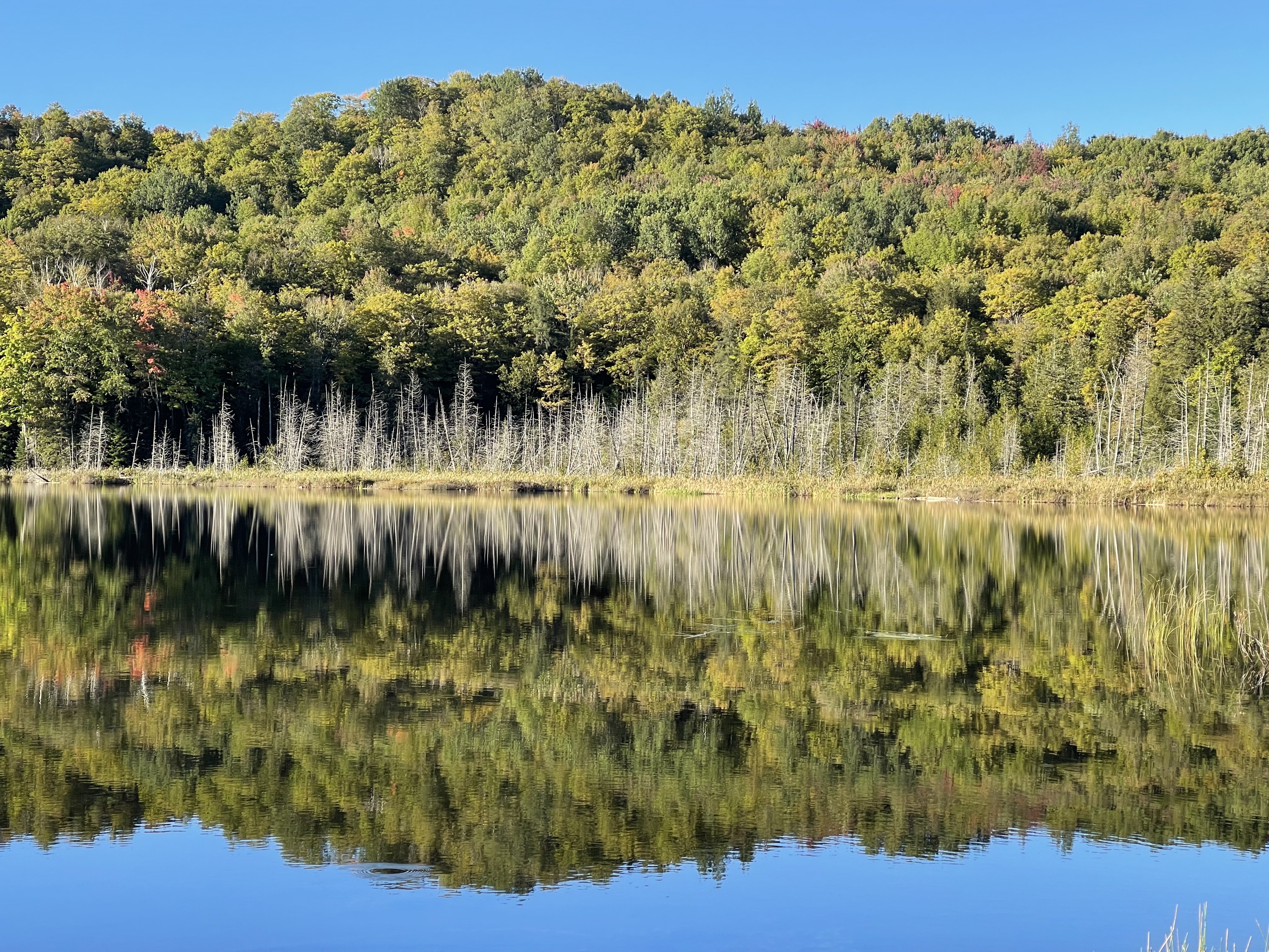
Fall is the most beautiful season in New England. With trees changing their colors from lush green to vibrant shades of yellow, orange, and red, every mountaintop and hillside is a stunning display.
A scenic road trip to New England during the peak foliage season is one of the main attractions in Fall and will give you a unique experience that you can’t get anywhere else. Every year, many visitors come to New England from all over the country to witness the spectacular fall color, hike some scenic trails, and taste the best maple syrup. We visited the White Mountain National Forest in New Hampshire last fall, and this year we started our foliage-peeping journey in northern Vermont.
Vermont, also known as Green Mountain State, encompasses thousands of acres of mountain terrain. With forests covering three quarters of the state and the highest percentage of brilliant maple trees in the country, Vermont offers autumn foliage color of unmatched splendor. A foliage watching trip to Vermont should be on one everyone’s bucket list. If you go, make sure you take the time to hike some of the most scenic trails in Vermont.
The Best Time to Visit for Foliage Watching
The leaves in Vermont begin to change their brilliant colors from mid-September in the northern part to mid-October in the southern part of the state. Within the span of a few weeks, every mountain transforms itself to put on its finest show. To catch the best time for leaf-peeping, visit the Vermont Fall Foliage Report to check weekly updates.
Here are two moderately difficult trails that lead you to the mountain peaks offering magnificent views in northern Vermont.
Wheeler Mountain Trail
- Difficulty: Moderate
- Time to Hike: 3.5-4 hours
- Pet Friendly: Yes
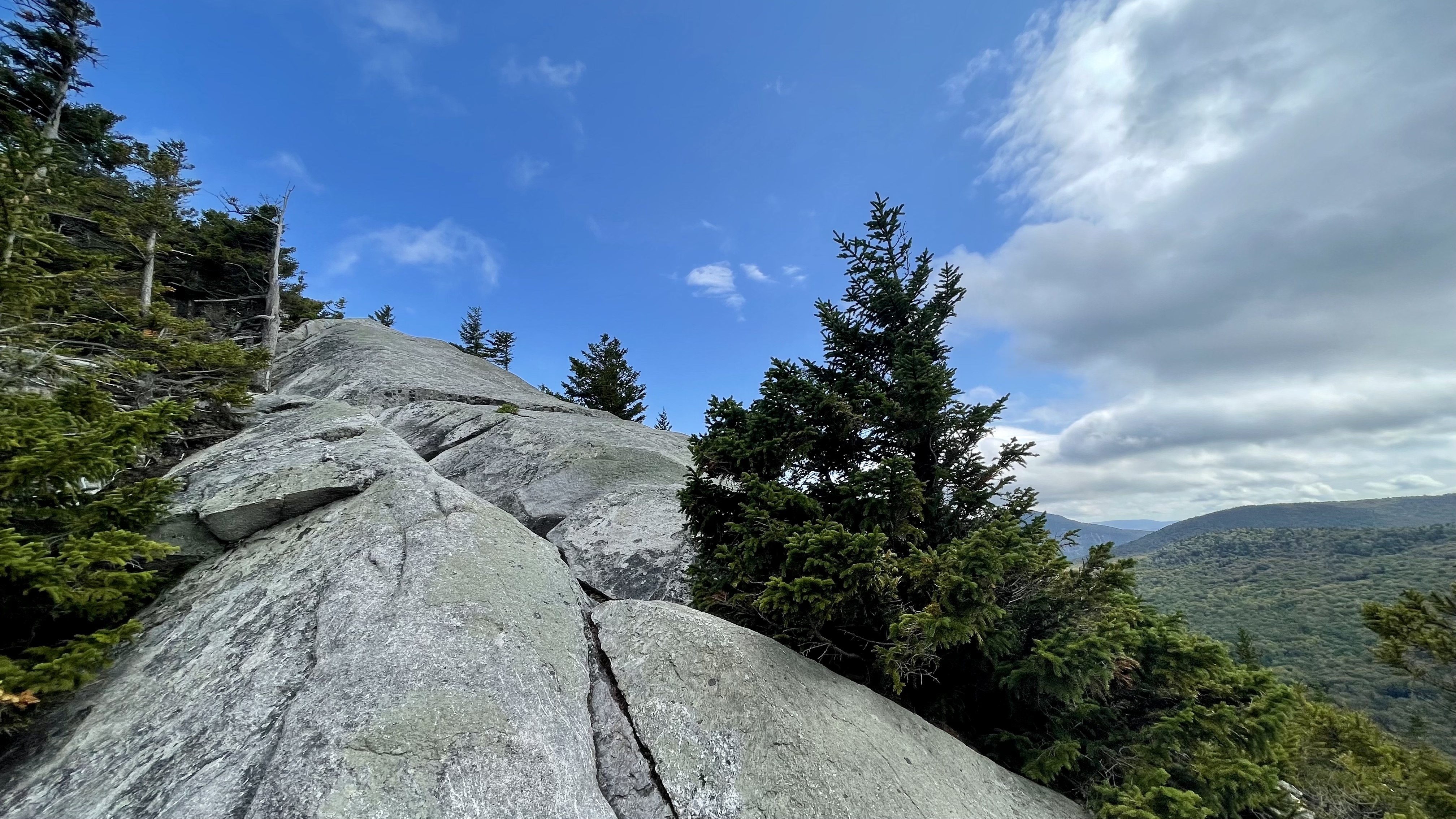
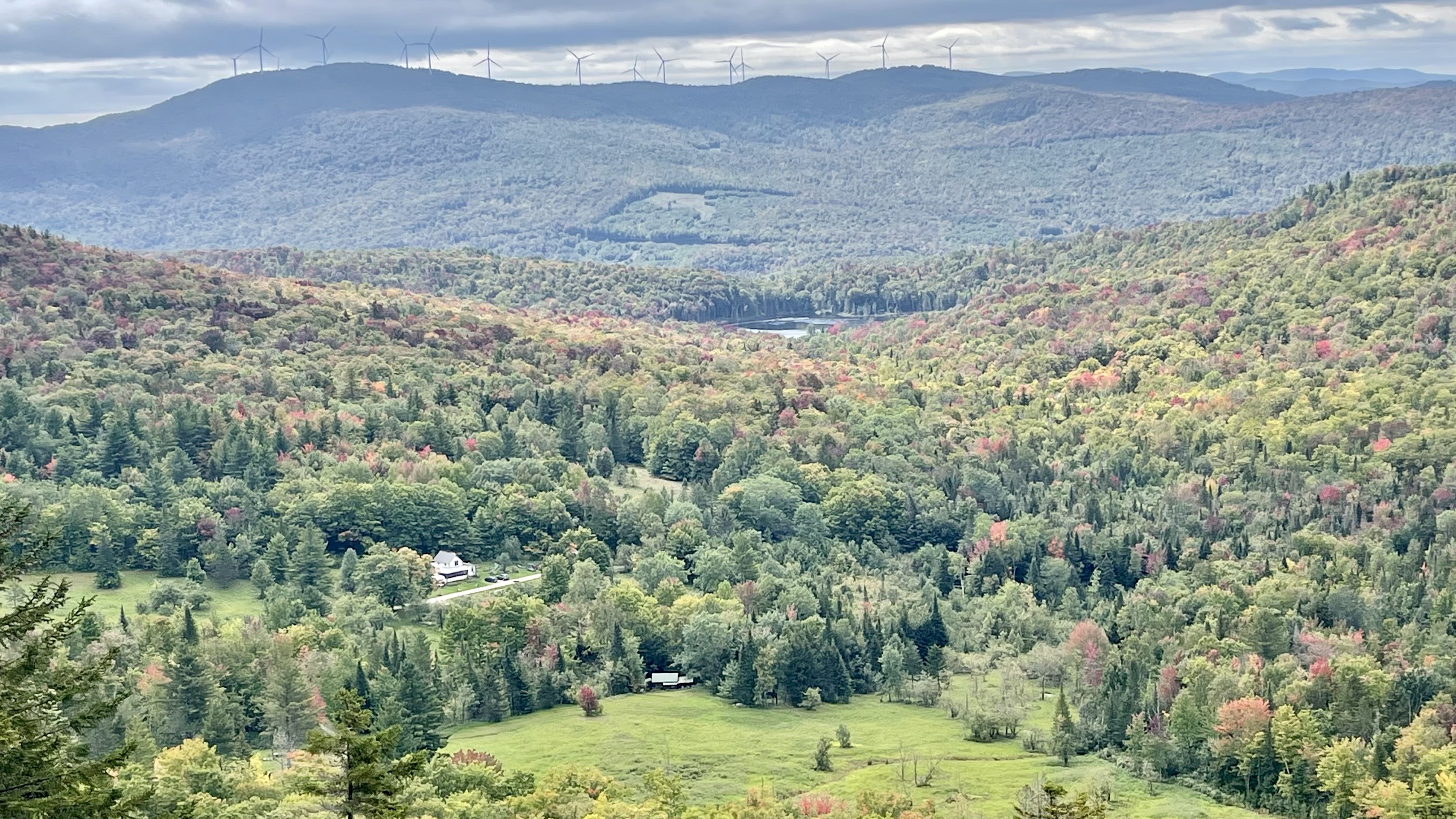
Wheeler Mountain Trail is a 4.3-mile out and back trail located in Sutton, Vermont. The trail meanders over many ups and downs on a stony path from the very beginning. Close to the summit, the trail travels over several exposed rock shields, wide and steep. If you are not comfortable with heights, this part could be a little challenging. However, it does not mean you have to miss the beauty of Wheeler Mountain. You don’t have to climb the final steep slabs to the summit to enjoy a bird’s eye view. After climbing up towards the top, you will notice the formation of the trail changes from dirt and stone to slabs. The very beginning of the exposed rock slides are not hard, and there is an open rock platform where you can enjoy the entire magnificent view overlooking the surrounding mountains, just like what you would see from the mountaintop. If you are an avid hiker, the summit is only about 10 minutes away.
Trailhead | The trailhead is located on Wheeler Mountain Road, just off of Route 5. Once you turn onto Wheeler Mountain Road, a dirt road, drive about 2.5 miles, you will see a wide open gravel-paved driveway on your right with a sign indicating Willoughby State Forest: that is the parking area for the Wheeler Mountain Trailhead. At the end of the parking lot, you will find the sign pointing to Wheeler Mountain Trail and a map with many hiking routes in Willoughby State Forest. Enter the trail and go through a short narrow path to another wide dirt road, look slightly on your left, you will find a sign indicating Trail on the other side of the road, and you begin the climb up to Wheeler Mountain.
Note: If you have been to Wheeler Mountain trail before, the old hiker trail is closed and an new trail is open now. The trailhead, mentioned above, is located on the other side of Wheeler Mountain Road.
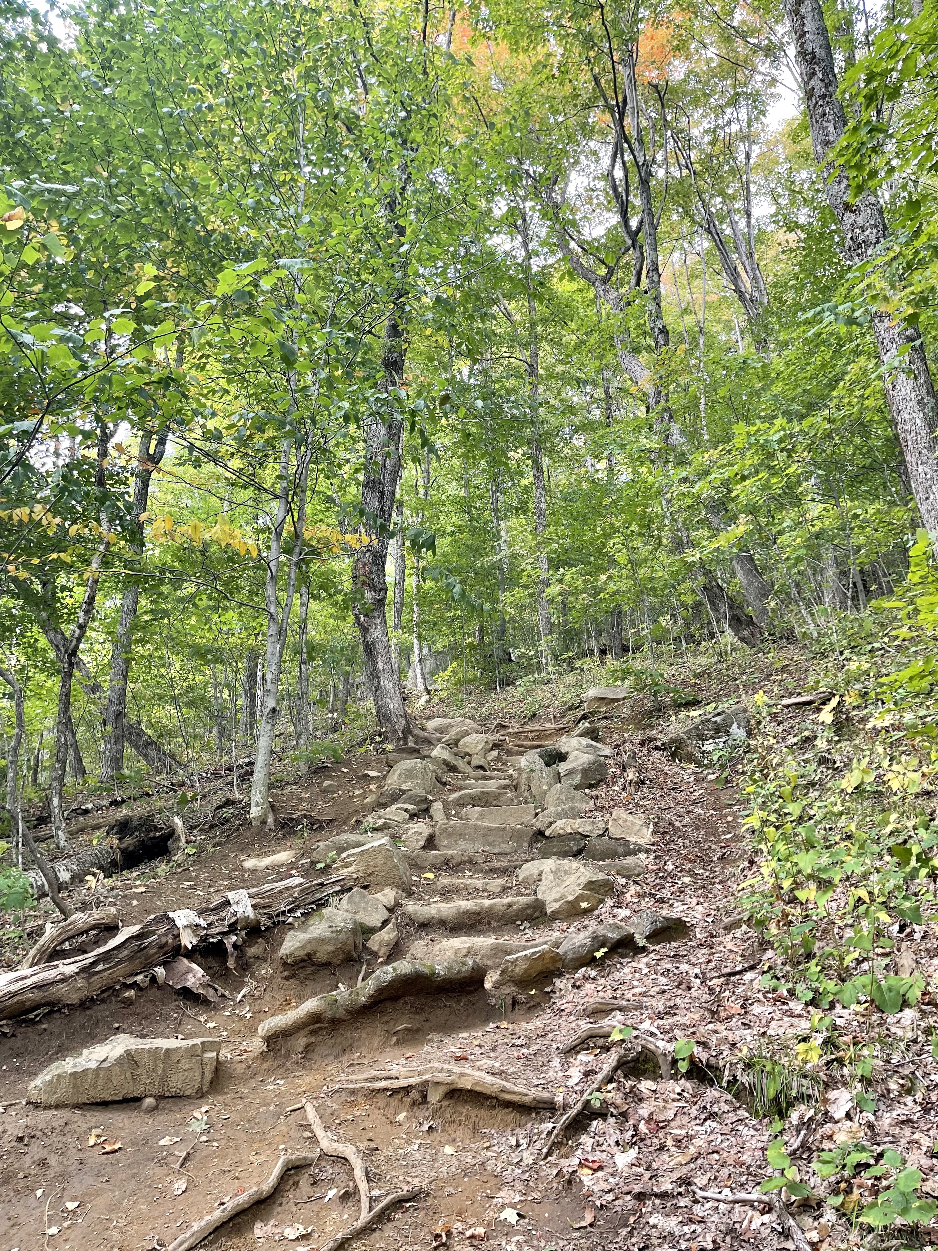
Hike | Wheeler Mountain Trail is well marked with BLUE blazes. Make sure you follow the blazes along your way because the cell phone signal is pretty spotty. If you are using a GPS map on your phone make sure you download it before you go. The hike to the summit is about 2.1 miles long, 1233 feet of elevation gain. It ascends gradually with a number of steep sections, large boulders, and some twists and turns until it is close to the summit. The last part of the hike to the top is a little challenging, you may need to scramble up, but the spectacular view looking over to Mt. Pisgah in the east and the Willoughby State Forest is totally worth the effort.
As you climb up the trail through the forest, keep your eyes open for many scenic rocks and outcroppings. Wheeler Mountain Trail is not an easy hike based on length and difficulty of climbing, but most of the trail is manageable and enjoyable for people of all ages.
Mount Pisgah Trail
- Difficulty: Moderate
- Time to Hike: 3.5-4 hours
- Pet Friendly: Yes
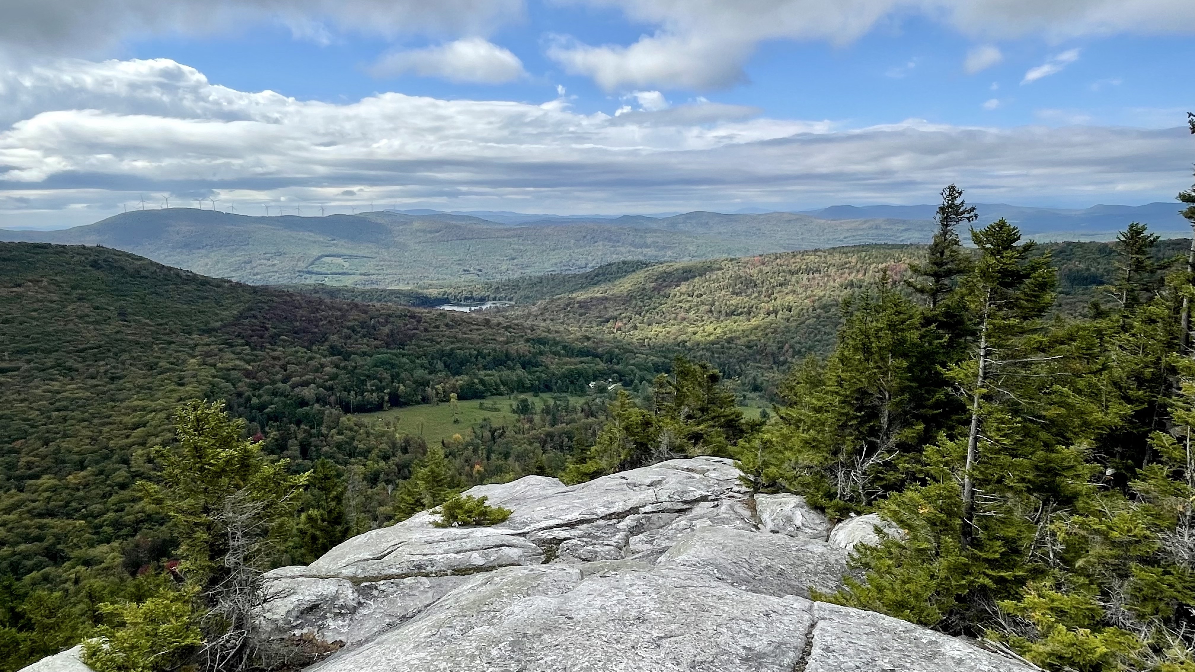
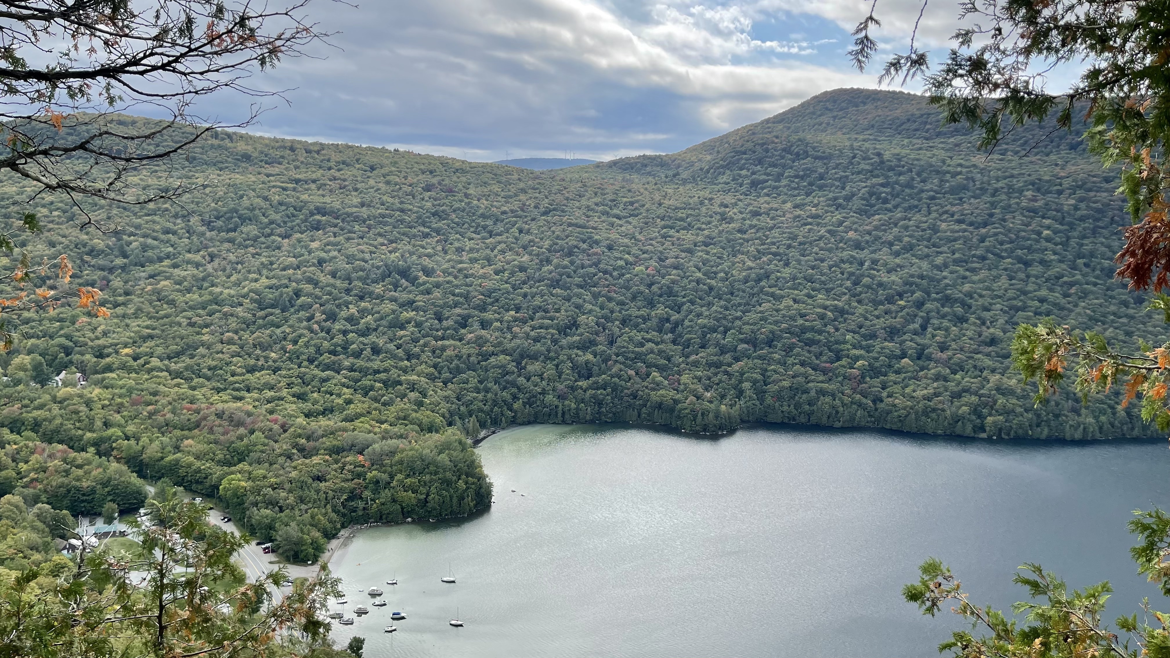
Mount Pisgah is located in Willoughby State Forest in Westmore, Vermont. There are a number of routes to hike Mount Pisgah, and the one I am sharing is Mount Pisgah South Trail, a 4-mile out and back family-friendly trail. The trail leads you to the highest lookout point of Mount Pisgah which offers a sublime view of the surrounding mountains and Lake Willoughby.
Trailhead | The south trailhead is located 5.7 miles north of the junction of Route 5 and 5A. Heading north on 5A, you can easily find a large parking area on your right and the sign to Mount Pisgah with a map at the back of the parking area.
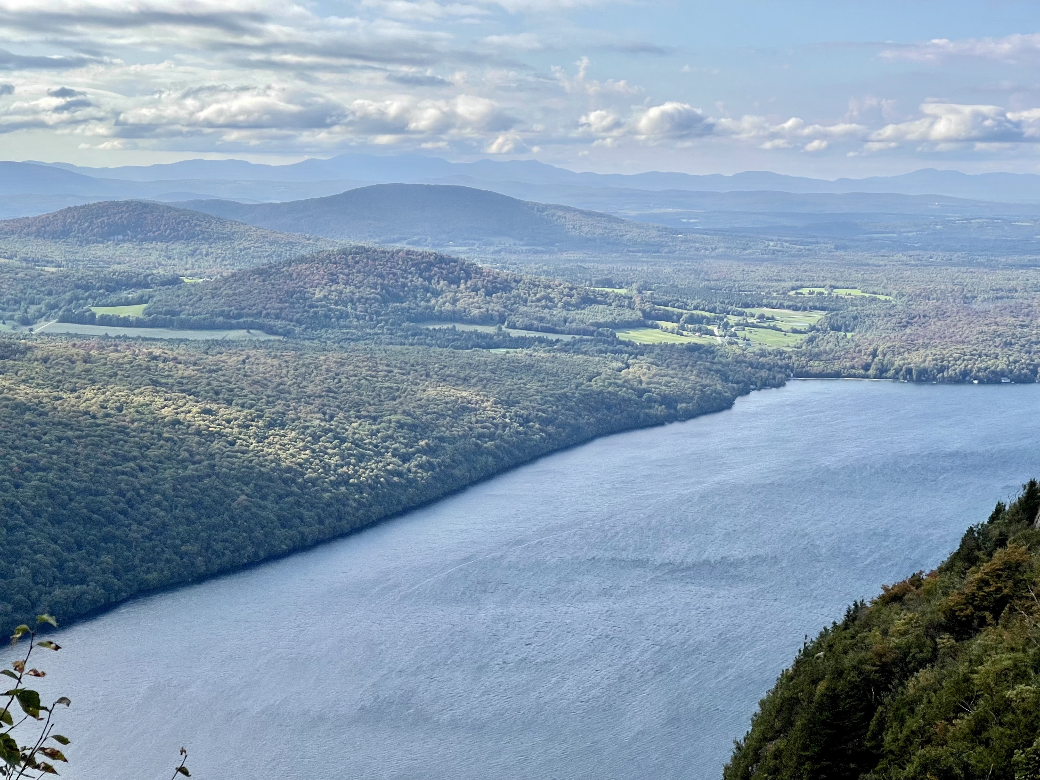
Hike | Just a short walk from the trailhead, cross Swampy’s Pond by a nice, long, wooden bridge, and start hiking Mount Pisgah. The trail is well marked with BLUE blazes. The hike to the top is about 2 miles, gaining 1653 feet. Mount Pisgah South Trail features some steep stone stairs, many switchbacks, and a few easy flat dirt paths. There are a few lookouts along the way, and the first one, Pulpit Rock, provides a stunning view of Lake Willoughby and Mount Hor. The final lookout of the South Trail is on a rock slab that gives you the sublime views of Lake Willoughby, southeast to the White Mountains, Victory Basin, Burke Mountain, and some of the Green Mountains.
A few tips for hiking in northern Vermont
- Hiking boots (not sneakers) are highly recommended due to the uneven trails
- Pack plenty of water and snacks
- Use strong bug spray, such as DEET or picaridin
- Sunscreen is suggested even on a cloudy day. The sun’s rays can burn you through the trees
- Download the offline map from AllTrails if you are already subscribed. If not, be sure to take a photo of the map at the trailhead and follow the blazes carefully. The cell phone signal is very weak in the forest, and in some sections, we didn’t get cell service at all.
- Choose a day with good weather to hike. Bad weather conditions such as rain, will make the hiking harder than usual and much less enjoyable.